Thursday, July 25, 2013

About a Month After the Calgary Flood of 2013

These pix are about a month after the peak of the flood.  We rode our bikes right down to the river to take a look.  The water is much lower and we can see the aftermath of the previous weeks.  The power of the water is very impressive as you can see.


 This is what we see when we cross onto the island in the river along the bike path.  Horizontal trees and sign posts.  Ripped up trees.

 Not sure where this boardwalk belongs, but not here.


 We live at the top of this hill; hence, our place was "high and dry".

 This is very interesting - all the river rock was deposited here - you can see the distinct line where it stops (above).
 All the trees were flattened/buried in the rock.


 Here is Joe for scale - so you can see the water pushed material up at least 10 feet on this tree.

 The river looks pretty calm tonight and it's starting to get its usual blue-green colour back - a change from the brown mud that it's been the last six weeks or so.

 There are also silt deposits further down.


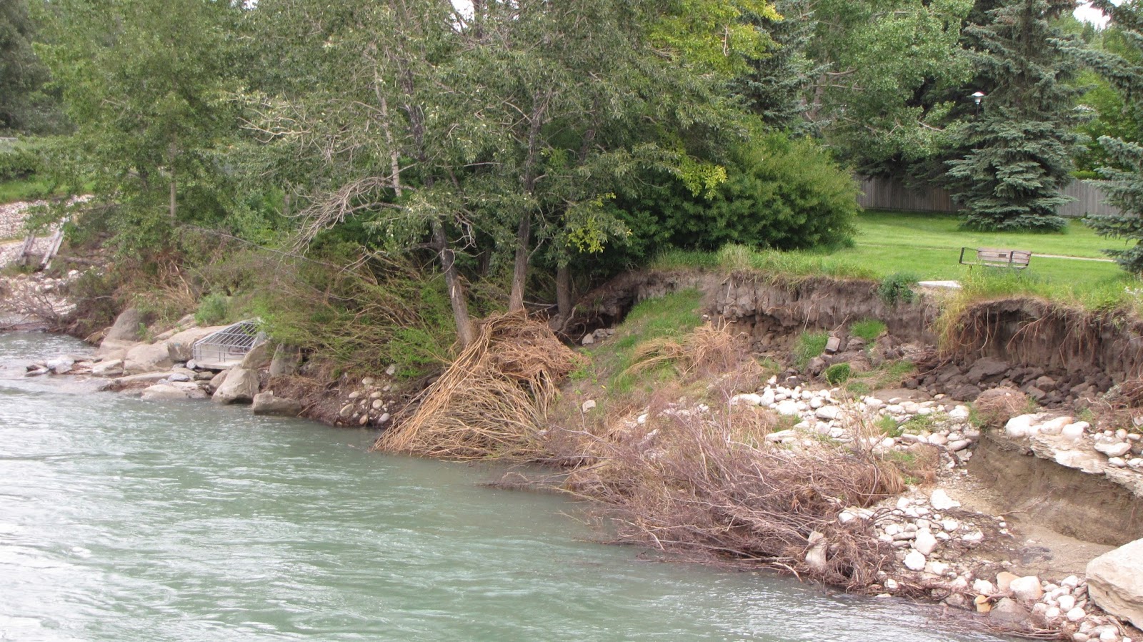
 This is the river bank on the south side - Bowness.  A lot of the river bank was eroded away and a lot of debris piled up in the trees along the bank.


One Week Later - Post Calgary Flood 2013

About a week after the flood, the water is down somewhat - to about the level of a "normal" bad flood year.  If you look closely, you'll see these pix are taken over a few days as the level gets a bit lower on succeeding pix.


 These are just "nature" shots because I like them.


 Compare the above shot to the previous post - the water has dropped significantly.  You can see land!


Calgary Flood - 2013

June 21, 2013
It had been raining and continued to rain, and rain, and rain.  In Calgary and in the mountains.  The result: 100 year record floods in the Bow Valley River flood plains and along other rivers in the foothills.  In Calgary record flooding with about 10% of Calgarians were evacuated from their homes The city closed off downtown Calgary, which is on the floodplain, so many of us could not get to work for about three work days (Friday, Monday and Tuesday).  Some not for over a week. 
 
On June 21, as I was not able to go to work, I was home and decided to walk over to look at the river and see exactly what it looked like.  We can see it if we walk about 3 minutes to the park about a block from our house.  This is what we saw:
 
 I thought we'd be the only ones out in the pouring rain - but apparently we aren't the only crazy ones - in fact there was actually a line up of vehicles waiting for a parking spot to get a look at the river from a safe vantage point.

 This is usually the river and two separate settling ponds.  Here they sort of blend together.
 Note the train on the bridge.  I learned that they park trains on the train bridges to keep the bridges from floating away in flood situations.

 Storm water gushing up into the settling pond.

 The Mayor declared "the river closed" - always someone...
 Normally we enjoy walking around down there looking at the birds.

 Hard to see - but across the river, backyards are flooded in Bowness.


Saving my Blog Post